Meet George Guy Thomas: The Navy Spook Who Made the Oceans Transparent & Changed Global Maritime Security Forever—From Space
"What if we could track every ship from space?" Naval legend George Guy Thomas turned this post-9/11 vision into reality with Satellite AIS—hailed as “more game-changing than GPS.” His expertise across sea, air, and space built a system tracking 230+ satellites, exposing hidden maritime threats.

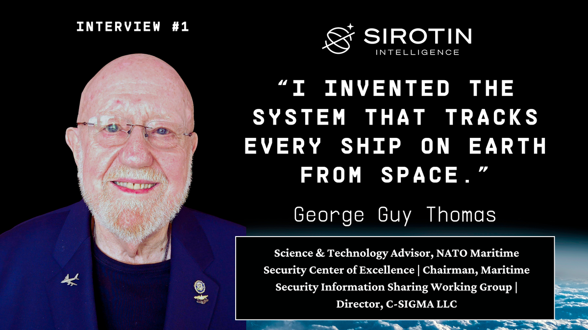
George Guy Thomas’s story begins with a question that would change the course of maritime history: “What if we could track every ship in the world from space?” The answer was as improbable as it was transformative—a collision-avoidance beacon, originally dismissed as impractical and impossible, reimagined into the backbone of modern global maritime surveillance. Today, over 230 Satellite AIS (S-AIS) receivers orbit the Earth, silently monitoring the seas, exposing what was once hidden, and forever altering how the world executes maritime security and marine commerce.
But the road to that breakthrough was shadowed by secrecy, danger, and a career that defied convention. Thomas, a Navy "spook," served in the classified world of military reconnaissance, where he achieved what no one else had: qualification in surface ships, submarines, reconnaissance aircraft, and space operations. A Cold War Silent Warrior in every sense, his missions ranged from covert submarine patrols in hostile waters to assisting in multiple MiG engagements over Vietnam to near-death flights in Navy and Air Force spy planes, their bellies grazing the ocean as fire control radars locked on, to covert work for the FBI. His life wasn’t just shaped by history—it helped make it.
Then came 9/11. As the nation scrambled to reimagine its vulnerabilities, Thomas saw an opportunity no one else did or even could. Amid war games and bureaucratic resistance, he dared to propose the impossible: transforming a ship's safety signal into a global tracking system by using space. His radical idea was met with skepticism—"It can't be done,” they said. But Thomas knew better.
“Did you know ships didn't have beacons like airplanes until 2008?” he often asks, with the most common reply being: “No, but I would like to meet the guy who made that happen!” His answer, delivered with characteristic understatement: “You're looking at him.”
This is the interview that finally brings his extraordinary story out of the shadows and into the light.
Your maritime journey began with a view of Corpus Christi Bay from your grandmother's home. How did growing up near the water influence your path from Sea Scouts in 1958 to becoming one of the Navy's first Space Operations Specialists?
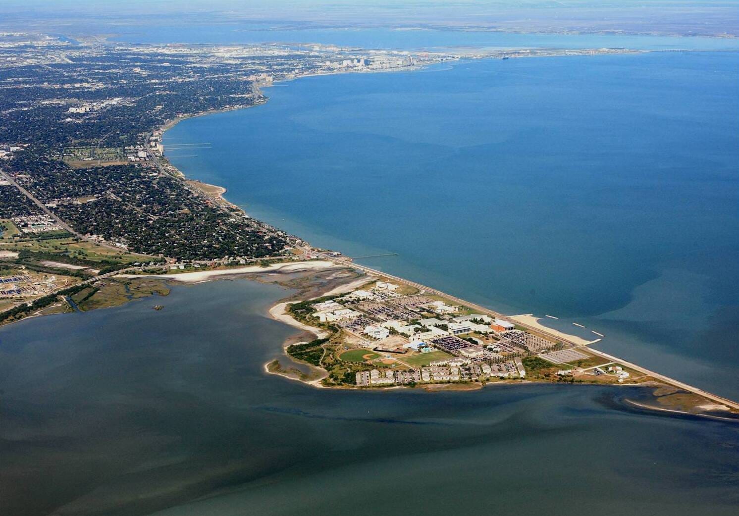
"I never could've imagined where that view from my grandmother's home would eventually lead me," Thomas begins, reflecting on his early years in Corpus Christi, Texas. The panoramic vista of Corpus Christi Bay, combined with the stories from his uncles who served in World War II, planted the seeds of a lifelong fascination with the sea. “The bay was always right there, a constant reminder of the bigger world out there waiting to be explored.”
The societal context of the time played a big role, too. "Naval officers in Corpus Christi were at the very top of the social hierarchy," he explains. "They were treated as heroes, even above doctors or lawyers. Seeing naval officers in their uniforms at church—men who had served in World War II—was inspiring."
Books also became a gateway to adventure. "The first book I ever read on my own was The Boy's Book of Sea Battles. That gift from my aunt really shaped my early interests," he recalls. Titles like Run Silent, Run Deep further fueled his dream of a naval career. “I was especially drawn to the idea of submarines. They seemed so mysterious and daring.”
In 1958, as a teenager, just after becoming an Eagle Scout, Thomas joined the Sea Scouts, an offshoot of the Boy Scouts focused on maritime skills. "I was a natural fit. The Sea Scouts gave me my first real taste of seamanship and maritime lore. At the time, I didn't realize how important those early lessons would be, though I already had discipline from my time as a junior leader in Boy Scouts."
While his journey from Sea Scout to becoming one of the Navy's first Space Operations Specialists wasn't linear, Thomas sees a clear through line in retrospect. "It was never about aiming for a specific destination. It was about curiosity and taking the opportunities that came my way and making the best of them. Growing up near the water instilled a sense of wonder and purpose. That environment set the stage for everything that followed, even though I didn't realize it at the time.”
You've had a rather unique career trajectory - serving on surface ships, submarines, and reconnaissance aircraft before moving into space operations. Could you walk us through how these diverse experiences shaped your understanding of maritime surveillance?
"Looking back, it's probably one of the oddest career paths anyone's ever had in the Navy," Thomas says with a chuckle. "But each step, even the ones that felt like setbacks at the time, ended up being crucial to understanding the bigger picture of maritime surveillance."
His journey began unexpectedly as a young, enlisted man on the USS HORNE during Vietnam. "I started as a deck force seaman - about as low as you could be," he recalls. "Then, through a most unusual string of events, I became the acting intelligence officer. The regular intelligence officer had an accident in the machine shop that took out his eye, and suddenly I was it. It is too long and involved to discuss here."

This early exposure to intelligence work caught the attention of the Naval Security Group (NAVSECGRU), an elite organization that would shape the rest of his career. "The officer in charge of their detachment on my ship approached me and said, 'You ought to become one of us.' When he mentioned duty stations like London, Paris, Rome, Tokyo, and Scotland, plus the chance to serve on submarines and fly on reconnaissance aircraft, I said, 'Where do I sign up?'"
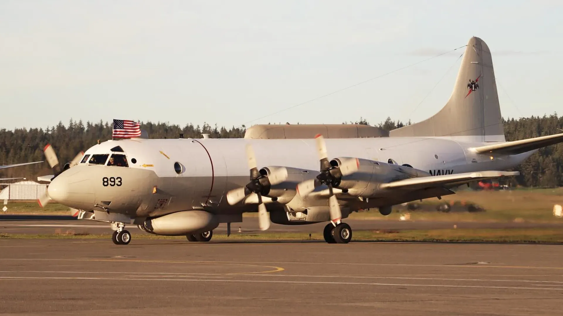
What followed was a career that reads like a Tom Clancy novel. Thomas served on three missile cruisers in combat, two submarines on classified missions, and flew in three different types of Navy and a like number of US Air Force, reconnaissance aircraft on dangerous missions in hostile airspace. "If you'd told me back then that I'd end up doing all of that, I wouldn't have believed it," he says. "Each role gave me a different perspective on maritime surveillance - from below the surface, on the surface, and from the air."
The value of this diverse experience became clear during his time working with the newest surveillance systems. "When I was testing the EP-3E and later the RC-135W, I could understand how these systems would be used in real-world situations because I'd been there. I'd seen it from every angle - surface, subsurface, and air. That's pretty rare in the Navy."
Thomas reflects on how this unconventional career path ultimately led him to become one of the Navy's first Space Operations Specialists. "It wasn't planned. But having that ground-level understanding of maritime operations from every possible perspective - that turned out to be exactly what was needed as we moved into the space age of maritime surveillance."
Perhaps most significantly, this varied background proved invaluable when he later conceived Satellite AIS. "All those years of operational experience - understanding how ships move, how we track them, and most importantly, how we lose track of them - that all came together when I had that 'aha moment' about putting AIS receivers in space. Sometimes you need to see a problem from multiple angles to find the solution."
Thomas's work immediately after 9/11 led to his third technical innovation. "One of the things that we decided from our meetings and our war games is we needed to have a single point of coordination and control for all the different programs involved in maritime awareness in the United States," he explains. "There were dozens of groups and programs being done at all levels of governance From all branches of the armed forces (Navy, Coast Guard, Marines, Army, Air Force), to several of the Departments, including Defense, Interior, State, Commerce, Justice, as well as the intelligence agencies, and state and local harbor police departments."
The solution to his recommendation was the creation of the Maritime Domain Awareness Program Integration Office. As Thomas notes, "My primary recommendation after those war games was, Let's have a single coordination point." One of that office’s first concrete acts was to fund Satellite AIS.
Your invention of Satellite AIS has been likened to technological breakthroughs like radar and GPS. Could you share the origins of this idea and how it has evolved to impact global maritime operations?
"The day of 9/11, the president tasked the Navy to look at what our vulnerabilities were to maritime terrorism," Thomas explains. "We put on a series of war games... and we had 1100 people in the first war game, about 900 in the second, and 500 at a follow-on seminar."
The urgency was palpable - they had just 12 days to organize what normally took three to four months to plan. The war games brought together an unprecedented mix of stakeholders from federal agencies down to city level, including private entities like shipyards, port managers, harbor operators and shippers.
What they immediately discovered was startling: "Nobody was tracking and identifying ships as they approached our shores. No effort at all until they were tied up or anchored. Then the US Coast Guard and other port authorities used clipboards with printed lists and binoculars, to check who they were by reading the names of the ships."
During the first war game, the Coast Guard mentioned the Automatic Identification System (AIS), a new collision avoidance tool, was going to be used for better situational awareness in our ports. Thomas, with his background in classified space systems, recalls his pivotal moment: "I asked if anyone ever thought about collecting that signal from space and using it as the traffic tracking system that we've been talking about needing since at least the 1960s."
The response was skeptical: "They said, 'It can't be done. No way that you have so many signals impacting that antenna. All you'd hear is white noise. They would jam each other. It would be self-jamming.'" But Thomas had unique expertise that gave him confidence: "I was beer drinking buddies with guys at NSA that wrote the kind of mathematical algorithms used to pull signals out of the noise, so that we could exploit them. But I couldn't tell them that then."
What followed was a determined 27-month quest for funding. Thomas partnered with ORBCOMM, the only company operating VHF satellites at the time. To validate the concept, he secured $110,000 from the US Coast Guard for a feasibility study at Johns Hopkins Applied Physics Lab, bringing together ORBCOMM's brilliant lead engineer David Schoen and three young PhDs from APL. After six weeks of study, they found no reason why S-AIS wouldn't work.
The project faced serious challenges—from technical skepticism to bureaucratic resistance. The Joint Spectrum Centre (JSC) wrote a critical paper claiming S-AIS would never work which, naturally, caused a great deal of concern, until Thomas's team discovered the JSC had misplaced a decimal point in their calculations. There were even attempts to classify the technology as a signals intelligence program, requiring a special clearance. The issue went all the way to the Secretary of Defense before being resolved in Thomas's favor.
ORBCOMM finally launched their first S-AIS six satellite constellation in June 2008, following a dramatic setback which caused a year-long delay. Russian officials had pulled the satellites from their launch vehicle, replacing them with sandbags, due to security concerns about certain team members' backgrounds in intelligence operations, including his.
Today, as Thomas notes, there are over 230 AIS receivers in space, tracking legal maritime traffic across the globe. While this system effectively monitors compliant vessels, Thomas acknowledges that illegal operators still try to evade detection. The technology has evolved far beyond its original security purpose, revolutionizing everything from commodity trading to environmental protection, to search and rescue operations to disaster recovery.
The impact has been profound. As Thomas writes in his historical account, S-AIS has created "The most significant paradigm shift in the maritime world since radar, the steam engine, or the screw propeller. Yes, even more game-changing than GPS... while GPS allowed ships to navigate with much better accuracy, it still left the ocean opaque while S-AIS has made the world's waterways much more transparent."
Satellite AIS led directly to Thomas's development of C-SIGMA (Collaboration in Space for International Global Maritime Awareness), a framework for international cooperation in maritime surveillance. In Thomas's vision, C-SIGMA would unite "nations of goodwill" - like NATO, EU, ASEAN members, and the Quad - in sharing maritime surveillance data to combat threats like illegal fishing, underwater cable interference, and maritime terrorism.
C-SIGMA has been described as a transformative approach to global maritime awareness through international collaboration. What were the key insights that led to its creation in 2005, and what have been the greatest hurdles in gaining widespread implementation and support?
"Over the last 12 years, numerous groups are putting together bits and pieces of what I proposed in 2005," Thomas explains, reflecting on C-SIGMA's origins. "By 2015, we had enough very good systems in space we could have built a very good global maritime awareness system, but we haven't."
The central insight was the need for global collaboration. "If you brought everybody's space system together that's out there, and have one collaborative and coordinated system, it would create a much better life for all involved in the maritime world, and that includes the majority of people on Earth," Thomas notes. When asked about including adversarial nations like China or Russia, he clarifies: "I generally say, all nations of goodwill."
This collaborative vision emerged from his experience working across regions. "I have been talking about maritime domain awareness with senior Japanese officials since 2004 and senior Indian officials since 2008. Not long after that “I told the Japanese: you need to get together with the Indians. And I told the Indians they needed to work with the Japanese because you both have a common enemy and a common problem. And if you share your information with each other you're going to do a much better job of understanding what is happening in the maritime domain, than if you try to do it alone." At the invitation of both countries’ governments, I visited Japan several times and India twice to discuss space-based Maritime Situational Awareness. Each time I repeated my recommendation that both countries work together, and expanded my recommendation to include Australia, New Zealand, Malaysia, Vietnam, Singapore, and the Philippines.
The urgency is clear in the scope of the challenges. "It's global. For instance, the illegal fishing that takes place off South America and off Africa is huge," Thomas emphasizes. His vision received significant validation when he presented it at the White House: Rahm Emmanuel, the chief of staff of the president at the time, said “that's the best, most unusual, innovative way of using space we've heard of."
According to the C-SIGMA documentation, the framework integrates nine critical elements - seven in space and two on the ground. These include AIS, signals intelligence satellites, synthetic aperture radar satellites, electro-optical imaging satellites, video optical satellites, communications satellites, and visible light detecting satellites. The ground elements focus on infrastructure for tasking these satellites and analyzing their collected data using AI and machine learning.
The basic concept of collaboration has proven particularly successful in Europe through FRONTEX and the European Maritime Safety Agency (EMSA). However, the vision of implementing C-SIGMA in critical areas like the Arctic, Gulf of Guinea, the Indian Ocean, and southwestern Pacific - which could serve as steppingstones toward truly Global Maritime Awareness - remains unrealized.
As Thomas puts it, drawing on his decades of experience: "The need is there; the capabilities are there. We just need to put them together in an intelligent way." The challenge now lies in fostering the international cooperation necessary to make this vision a reality.
As the author of Implementation Task #1 of the U.S. National Space Policy of 2010, how did you approach integrating maritime awareness into the broader framework? What challenges did you face in translating technical concepts into actionable policy?
"I gave that brief to several different White House groups," Thomas recalls, "because we were writing the Obama space policy at the time. There were 100-150 people in some of these meetings. I also briefed a number of ranking people person to person. Routinely, the feedback echoed Rahm Emanuel’s assessment as to its utility and value. It was not an accident C-SIGMA was Implementation Task Number One."
The Presidential Policy Directive Four (PPD-4) Implementation Task #1 was groundbreaking in its scope. According to the C-SIGMA documents, it directed multiple department secretaries–Defense, Homeland Security, Transportation, State, and Commerce–to develop an unclassified, internationally available program fostering collaboration using civil and commercial space systems. The goals were ambitious:
● Enhanced safety of life at sea
● Increased mutual security for maritime domain users
● Improved protection of the maritime environment and sea resources
● Better monitoring of Marine Transportation System conditions and performance
Implementation faced significant bureaucratic hurdles. "You have to have congressional authority to do some things back in those days," Thomas explains. Even after becoming the Office's Chief Technical Officer rather than Science Advisor, he found that "politics got in the way."
The experience echoed an earlier challenge he'd faced: "I was the original writer of the National Strategy for Maritime Security. I had put two and a half three years of effort into it, after I had spent over 2 years doing the basic research. That is a total of 5 years." Despite this work, credit and implementation often became contentious issues, highlighting the complex politics of policy implementation.,
Today, Thomas views the task's continued relevance through the lens of current threats: "The organizations who are tracking all these ships that are covertly breaking these cables and everything... they're putting together the pieces of what I have said needed to be done since 2005." And it is still only being done in a few locations, rather than globally. And it is globally where the real payoff is. His frustration with the delayed implementation is clear: "By 2015, ten years ago now, we had sufficient and good enough systems in space. We could have built a very good global system, but we haven't. By the way, the space systems are getting better and better, and there are more and more of them."
How do you think these new technologies—like AI, machine learning, and advanced satellite systems—are advancing maritime surveillance, or are there dangers involved? What do you think is going to happen in the next 5 to 10 years?
"I think there’s some dangers involved in the implementation of AI, but not with this program," Thomas begins. "In C-SIGMA we’re looking at finite sets of information. If you put those data sets into what we used to call a fusion system back in the day—it becomes powerful, given the power of today’s AI capabilities."
Reflecting on his experience, Thomas says, "When I directed the Air Force test in 1980-81, we had seven sensors on the RC-135W. The way all of that data was being integrated was through one man—the Airborne Mission Supervisor. His job was taking seven different inputs, making sense out of it, and then typing up messages. I said, 'We need to build a database and a data link to bridge this.' That became the Tactical Intelligence Information System (TIBS), —the first system to ingest data from seven different sensors and fuse it using what we’d now call AI, though it was very basic AI back then."
He elaborates further, "I’ve been looking at AI and machine learning from early in my career. In fact, back in 1985, I wrote my thesis on the future of AI. I always said we’d need machine learning to bring together dissimilar sensors in surveillance. That’s what AI/ML does—it understands things and builds on them."
Looking ahead, Thomas predicts a landscape shaped by constant advancements and countermeasures. "It’s going to be a war of move and countermove. We’re already seeing that in Ukraine—jamming, false information, disinformation. There are so many types of jamming: deception jamming, where you make people look somewhere else, and brute force jamming, where you overload the receiver with so much energy it can’t function."
Thomas underscores how these capabilities will shape surveillance and counter-surveillance in maritime and other domains. "The next 5 to 10 years will be huge. These technologies will make fusion systems even smarter, faster, and more precise. But it’s also about disruption—whether it’s misleading the enemy about your position, as we did back in Desert Storm, or using AI to counter their moves. It’s all about who can adapt faster. This is as true in the unclassified world as it is in the classified one." He should know. He has been deeply involved in both.
Footnote: In the aviation world, it took 40 years (1909 to 1949) from conception to implementation to establish the International Civil Aviation Organization (ICAO), which coordinates international air traffic tracking. Thomas hopes C-SIGMA's implementation won't require four decades, though the initiative has already passed its 20-year mark.
About George Guy Thomas
George Guy Thomas is a globally recognized expert in maritime security, intelligence operations, and space-based surveillance systems. With over six decades of service and expertise, Thomas has been instrumental in creating the systems and strategies that define modern maritime awareness and global security.
A retired U.S. Navy Commander, Thomas dedicated 23 years to intelligence and reconnaissance operations, serving in hostile environments on ships, submarines, and aircraft. As one of the first U.S. Navy officers designated as a space operations sub-specialist, he was the first to achieve quadruple qualifications across surface, submarine, air, and space domains. Throughout his service, Thomas operated in high-stakes Cold War missions, participated in 28 MiG encounters with nearly 20 successful engagements, and contributed to classified intelligence collection efforts. His career highlights include leading the operational testing and evaluation of the Navy's EP-3E reconnaissance aircraft and bringing to life the Air Force's RC-135V/W Rivet Joint Block III fleet of 16 aircraft, advancing airborne intelligence capabilities. He also contributed to the development of classified and tactical intelligence systems, including the conception of the Tactical Information Broadcast System (TIBS) and helping to create the Integrated Broadcast System (IBS).
Thomas is the inventor of Satellite AIS (S-AIS), a transformative technology enabling global ship tracking and improving global maritime safety and security. This innovation has been widely recognized as one of the most significant maritime advancements since radar. Building on this achievement, he conceived and developed C-SIGMA (Collaboration in Space for International Global Maritime Awareness), an international initiative that integrates unclassified space-based systems to enhance maritime situational awareness. C-SIGMA, which remains a cornerstone of global maritime awareness, directly supports U.S. National Space Policy (2010) and fosters international collaboration to improve safety, environmental protection, and resource conservation.
A pivotal contributor to the National Maritime Security Strategy (2005) and the National Maritime Domain Awareness Technology Roadmap (2005), Thomas played a central role in shaping the international approach to maritime domain awareness, with these documents having far-reaching impact beyond U.S. borders. While Task #1 of the U.S. National Space Policy Implementation Directive (2010) focused on international cooperation in utilizing space systems for maritime safety and security, its implementation was unfortunately shelved due to unknown internal disagreements.
Currently, Thomas serves as Chairman of the Maritime Situational Awareness Working Group within NATO ACT Combined Joint Operations from the Sea Centre of Excellence, which operates under the leadership of a U.S. Navy 3-star admiral and British Commodore deputy. In this role, he facilitates collaboration among international stakeholders to address maritime security, environmental, and economic challenges. As an advisor to the NATO Maritime Security Centre of Excellence in Istanbul, Turkey, Thomas continues to contribute to the development of NATO's maritime strategies, enhancing global coordination in maritime surveillance and situational awareness.
Thomas's contributions have earned him numerous accolades, including the Space Foundation's Lifetime Achievement Award (2021) for his pioneering work in maritime safety using space system capabilities, the USGIF Individual Achievement Award (2015) for advancing space-based maritime awareness, the Distinguished Civilian Service Award (DCSA) - the highest award given to a civilian by DHS and the first awarded to someone assigned to the USCG in 4 years, and multiple nominations for the National Medal of Technology and Innovation and the Space Technology Hall of Fame. As an author, he has published foundational works, including "A Silent Warrior Steps Out of the Shadows" and "New Sentinels of the Seas – Satellite AIS and the Birth of Global Maritime Awareness."